
Hornocal Viewpoint: Altitude, Road & How to Get There
Hornocal viewpoint sits around 4,350m above Humahuaca. How to get there, road conditions, altitude, timing and whether a 4x4 is useful.
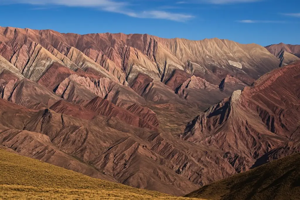
The Serranía de Hornocal is a mountain range whose exposed rock face shows roughly fourteen distinct color bands — a more extreme, higher-altitude version of the striping you see at Purmamarca and Maimará. The viewpoint sits at around 4,350m, reached by a 25km gravel road that climbs steeply out of Humahuaca, and on a clear day the panorama is genuinely one of the most dramatic in the province.
This isn't a casual stop — it's a real journey to a real high-altitude viewpoint, and it should be planned as such. Most visitors go as a half-day or full-day trip from Humahuaca, either self-driving, hiring a remise, or joining an organized tour, and the payoff is a viewpoint with essentially no infrastructure: no café, no gift shop, just the mountain and the wind.
Getting there
The Hornocal is reached via a 25km gravel (ripio) road climbing out of Humahuaca — allow 45 minutes to over an hour each way depending on conditions and your vehicle. A high-clearance vehicle is strongly recommended; a 4x4 is not always strictly required in dry conditions but is the safer choice, especially after rain. Most travelers without a suitable vehicle of their own book a remise or tour from Humahuaca rather than attempt it in a standard rental car. There is no public bus service to the viewpoint.
When to go
Morning is generally considered best for both light and weather — clouds and wind tend to build through the day at this altitude, and visibility can drop fast. April-November is the more reliable season for the road; December-March rains can make the gravel surface treacherous or impassable, and trips get cancelled or postponed — build flexibility into your schedule if you're visiting the Hornocal in summer.
Altitude
The elevation shown is a reference point; the route may climb higher. Plan gradual ascent and seek individual medical advice before high-mountain travel. A suggested itinerary does not establish medical suitability. If symptoms appear, do not continue ascending; seek medical advice and descend if symptoms worsen. CDC guidance on altitude.
Practical notes
- There's little to no cell signal on the access road or at the viewpoint — let someone know your plans before you go.
- No food, water, or toilet facilities at the top — bring what you need, including more water than feels necessary given the altitude.
- Wind at the viewpoint is often strong and cold even when Humahuaca below is warm and sunny — pack a proper windproof, warm layer regardless of season.
- Download the route before leaving Humahuaca and keep your return arrangements available offline.
- Keep the visit to a reasonable length once you arrive; there's not much benefit to lingering for hours at this elevation, and altitude fatigue compounds quickly.
Frequently asked questions
Can I drive to the Hornocal myself in a normal rental car?
It's possible in good, dry conditions with a careful driver, but the gravel road is steep and rutted in places, and most rental agreements and travelers are better served by a high-clearance vehicle or a local remise/tour.
How much time should I budget for the Hornocal round-trip from Humahuaca?
Plan for at least half a day — roughly an hour each way on the road plus time at the viewpoint — and don't rush it given the altitude.
Is the Hornocal worth it if I've already seen Purmamarca's Cerro de los Siete Colores?
Most travelers who do both say yes — the Hornocal's colors are more dramatic and the setting far more remote, though it demands more time, altitude tolerance, and logistics to reach.
Sources and how to use this guide
Trip organisation is an editorial suggestion. Confirm changing opening times, access and conditions with the relevant sources. References do not imply an on-site visit by our newsroom.
Report a correction →Make the trip work for you
Choose by trip length, compare bases, solve transport or start with a region. Each guide connects practical decisions with places and the trip planner.