
Salinas Grandes, Jujuy: Salt Flat Travel Guide
Visiting the Salinas Grandes salt flat from Purmamarca: getting there, altitude, when to go, and what a trip to the salar actually involves.
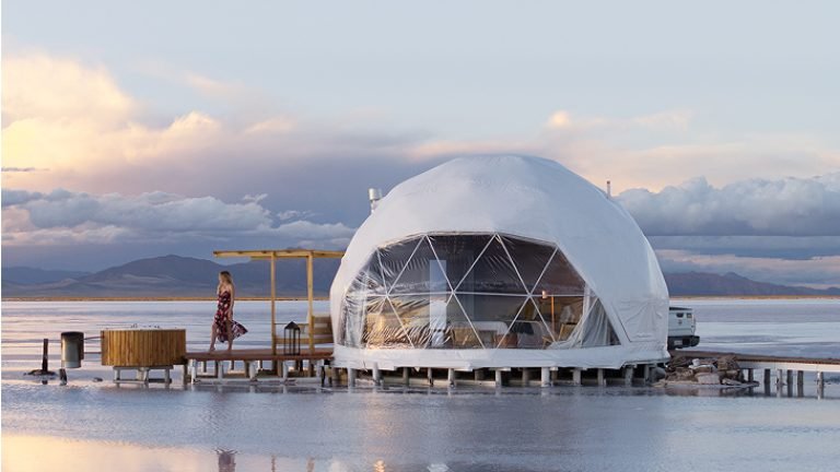
Salinas Grandes is a high-altitude salt flat straddling the border of Jujuy and Salta provinces, sitting at about 3,450m on Ruta Nacional 52 — the road that eventually climbs on to the Paso de Jama and the Chilean border. The white crust, several meters thick in places, is mined commercially and also draws travelers for the stark, mirror-like landscape, especially where thin standing water creates reflections after rain.
It works well as a half-day or full-day trip from Purmamarca, about 66km away along a road that climbs through several distinct microclimates. There's a small cooperative-run visitor area with basic stalls selling salt-based crafts, but this is otherwise a genuinely empty, high-altitude landscape.
Getting there
From Purmamarca, it's about 66km via RN52 on a road that climbs steeply through the Cuesta de Lipán switchbacks before dropping onto the flat. From San Salvador de Jujuy, the total road distance is about 130km. A standard car can usually manage the route in good weather, but many travelers join an organized tour or hire a remise given the altitude gain and the switchback driving. No regular public bus serves the salar directly — you need a car, tour, or arranged transport.
When to go
The dry surface, roughly April-November, is what most photos show — a cracked white expanse extending to the horizon. During and just after the summer rains (December-March), a thin layer of water can pool on parts of the salar, creating the mirror effect popular on social media, but road conditions to get there are less reliable in this season and access can be affected by storms. There's no single "correct" season — it depends whether you want the classic dry hexagon-crust look or the reflective water look, and you can't fully predict the water conditions in advance.
Altitude
The elevation shown is a reference point; the route may climb higher. Plan gradual ascent and seek individual medical advice before high-mountain travel. A suggested itinerary does not establish medical suitability. If symptoms appear, do not continue ascending; seek medical advice and descend if symptoms worsen. CDC guidance on altitude.
Practical notes
- The visitor area has basic cash-only stalls; there are no ATMs anywhere near the salar.
- Cell signal is unreliable to nonexistent once you're on the salt flat itself.
- Sun protection is essential — UV reflecting off the white salt surface at this altitude is intense even on cool days; sunglasses and sunscreen are not optional here.
- Guided walks or tours of the salar are offered by the local cooperative and are worth taking if you want context on the salt-mining process, not just photos.
- Budget half a day minimum from Purmamarca including driving time; a full day if you want to combine it with lunch in Purmamarca or a stop at the Cuesta de Lipán viewpoint.
Frequently asked questions
Is Salinas Grandes as impressive as Bolivia's Salar de Uyuni?
They are different experiences. Salinas Grandes can be visited as a day trip from Purmamarca and offers the classic white salt-flat landscape, while Uyuni is a separate destination in Bolivia that needs its own travel planning.
Can I drive across the salt flat myself?
There are marked areas where vehicles are permitted to drive short distances onto the crust, but this should be done carefully and ideally with local guidance — straying off marked routes risks getting stuck or damaging a fragile surface.
Do I need oxygen or altitude medication for a day trip here?
Preventive medication is an individual medical decision. Discuss the route and planned altitude with a qualified health professional before travelling; do not self-prescribe from an itinerary.
Sources and how to use this guide
Trip organisation is an editorial suggestion. Confirm changing opening times, access and conditions with the relevant sources. References do not imply an on-site visit by our newsroom.
Report a correction →Make the trip work for you
Choose by trip length, compare bases, solve transport or start with a region. Each guide connects practical decisions with places and the trip planner.