
Yala, Jujuy: Lagoons & Cloud Forest Near the Capital
Yala travel guide: the Termas de Reyes area, lagoon trails, and an easy yungas day trip just outside San Salvador de Jujuy.
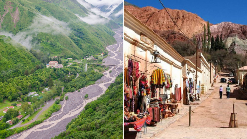
Yala sits just 14km from San Salvador de Jujuy, at a comparatively mild 1,500m, making it the easiest nature escape from the capital and a useful stop if you're short on time or easing into the region before heading up into the Quebrada. It's part of the yungas belt — subtropical cloud forest that runs along the eastern flank of the Andes — and the change in vegetation from the dry valley around San Salvador is immediate.
The main draw is a small network of lagoons within reach of the road, along with nearby access to trails and the Termas de Reyes area's warm-water springs a bit further on. It's a low-key, low-altitude day rather than a headline attraction, but it's a genuinely pleasant one, and useful for travelers who want a taste of the yungas without committing to the longer trip out to Calilegua.
Getting there
Just 14km from San Salvador de Jujuy, about 20-30 minutes by car on a paved road; local buses and remises run this route regularly since it's essentially a suburb-distance trip from the capital. No 4x4 or special vehicle needed. This makes Yala one of the few destinations on this list that's realistically doable as a half-day trip without a rental car.
When to go
Being at low altitude and closer to the yungas' more humid climate, Yala sees more consistent rainfall than the high Quebrada, particularly December-March. The lagoons and forest look their greenest right after rain, though trails can be muddy. April-November is drier and more comfortable for walking, with mild temperatures typical of the lower valleys rather than the cold nights of the Puna.
Altitude
The elevation shown is a reference point; the route may climb higher. Plan gradual ascent and seek individual medical advice before high-mountain travel. A suggested itinerary does not establish medical suitability. If symptoms appear, do not continue ascending; seek medical advice and descend if symptoms worsen. CDC guidance on altitude.
Practical notes
- This is an easy day trip — no overnight logistics required, though there are some accommodation options in the area if you want to base here.
- Cash is still the more reliable option at small local vendors, though the proximity to the capital means card acceptance is somewhat better than in the more remote Quebrada towns.
- Cell signal is generally fine given the proximity to the capital.
- Combine with a stop at Termas de Reyes if you want a soak in warm mineral water after walking — check current opening arrangements locally.
- A few hours is enough for the lagoon area; a full day if you add the hot springs.
Frequently asked questions
Is Yala worth visiting if I'm short on time and only doing the Quebrada?
If your itinerary is Quebrada-focused and tight on days, Yala is the first thing to cut — it's a pleasant lower-key stop, not an essential one, best suited to travelers with an extra half-day near the capital.
Do I need a guide to visit the Yala lagoons?
No — the lagoon area near the road is accessible independently; a guide is only useful if you want to go deeper into the yungas forest trails.
Can I do Yala and Termas de Reyes in the same day from San Salvador de Jujuy?
Yes, they're close to each other and both a short drive from the capital, making them an easy combined half-day or full-day trip.
Sources and how to use this guide
Trip organisation is an editorial suggestion. Confirm changing opening times, access and conditions with the relevant sources. References do not imply an on-site visit by our newsroom.
Report a correction →Make the trip work for you
Choose by trip length, compare bases, solve transport or start with a region. Each guide connects practical decisions with places and the trip planner.