
La Quiaca, Jujuy: Argentina's Border With Bolivia
La Quiaca travel guide: crossing to Villazón, Bolivia, altitude at 3,442m, and what to know about Argentina's northernmost town.
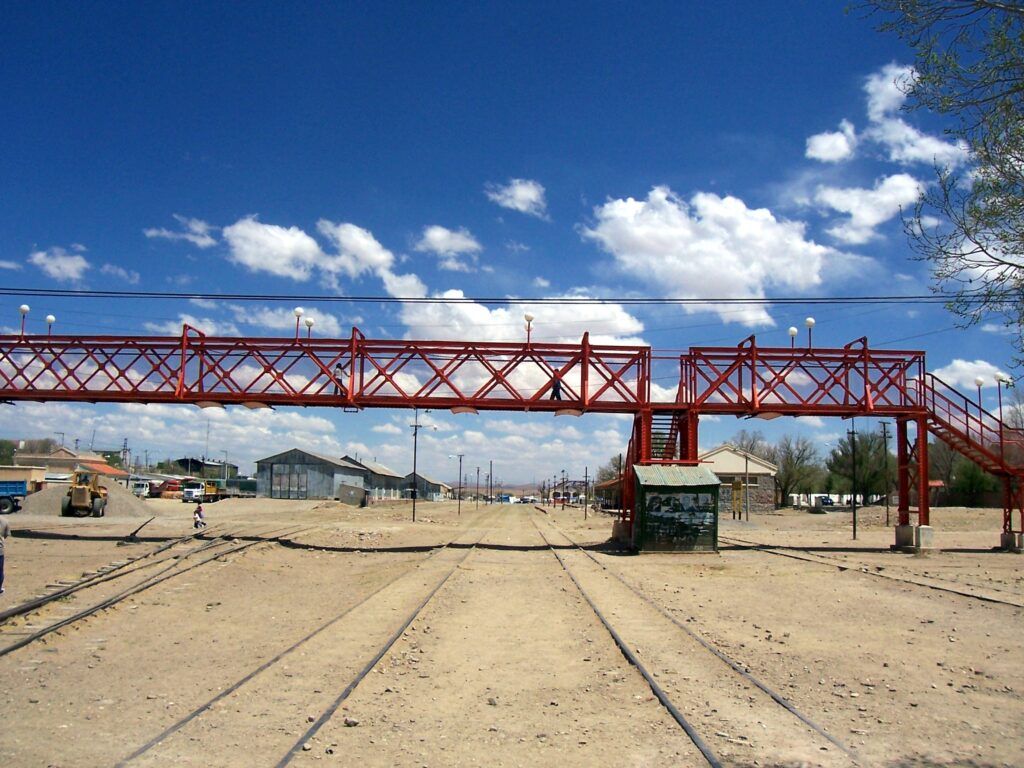
La Quiaca sits at 3,442m, about 290km from San Salvador de Jujuy, right at Argentina's northern edge — across a bridge is Villazón, Bolivia, and the two towns function as a single, informal border economy even though they're in different countries. For most travelers, La Quiaca is either a deliberate endpoint (the literal top of a Jujuy road trip) or a crossing point into Bolivia rather than a destination in its own right.
The town itself is functional rather than picturesque — a genuine Puna border town with a market, basic services, and a steady flow of cross-border traffic — but the surrounding high plateau landscape, and the novelty of standing at Argentina's northernmost point, are worth the trip for travelers who've made it this far up the Quebrada and Puna.
Getting there
About 290km from San Salvador de Jujuy via RN9, roughly 4.5-5.5hr by car, passing through Purmamarca, Tilcara and Humahuaca on the way — effectively the full length of the Quebrada de Humahuaca corridor. Regular long-distance buses run this route from San Salvador and connect onward from Humahuaca; it's one of the better-served routes for travelers without a car, given how many people transit through en route to or from Bolivia. The road is paved the entire way.
When to go
April-November is dry and clear, with genuinely cold nights year-round given the altitude — this is the coldest destination on this list in winter, with hard freezes standard June-August. December-March brings the summer rains common to the wider region, generally lighter here than in the lower Quebrada but still capable of disrupting travel plans.
Altitude
The elevation shown is a reference point; the route may climb higher. Plan gradual ascent and seek individual medical advice before high-mountain travel. A suggested itinerary does not establish medical suitability. If symptoms appear, do not continue ascending; seek medical advice and descend if symptoms worsen. CDC guidance on altitude.
Practical notes
- Bring your passport for the border crossing to Villazón even for a same-day visit — Argentine and Bolivian immigration formalities apply in both directions.
- Cash — ideally both Argentine pesos and Bolivian bolivianos in small amounts — is far more useful here than cards, particularly on the Bolivian side.
- Cell signal and roaming can behave unpredictably this close to the border — check with your carrier before relying on data here.
- Services thin out noticeably compared to Humahuaca or Tilcara; treat La Quiaca as a practical stop rather than expect resort-level tourist infrastructure.
- Nights are genuinely cold year-round — pack real winter layers regardless of season.
Frequently asked questions
Can I cross into Villazón, Bolivia, as a day trip from La Quiaca?
Yes, many travelers walk across for a few hours — bring your passport and check current entry requirements for Bolivia in advance, as these can change.
Is La Quiaca worth visiting if I'm not crossing into Bolivia?
It's a long way to come for a town that's mostly functional rather than scenic — most travelers who go without crossing the border are completionists doing the full length of the Quebrada, or are specifically drawn to the high Puna landscape and the novelty of Argentina's northernmost point.
How cold does it get in La Quiaca?
Winter nights (June-August) regularly drop well below freezing given the altitude — this is genuinely cold high-plateau weather, not the mild "Andean sun in the day" conditions some travelers expect from photos of the region.
Sources and how to use this guide
Trip organisation is an editorial suggestion. Confirm changing opening times, access and conditions with the relevant sources. References do not imply an on-site visit by our newsroom.
Report a correction →Make the trip work for you
Choose by trip length, compare bases, solve transport or start with a region. Each guide connects practical decisions with places and the trip planner.